FISHING ● PADDLING ● HIKING ● BIRDING
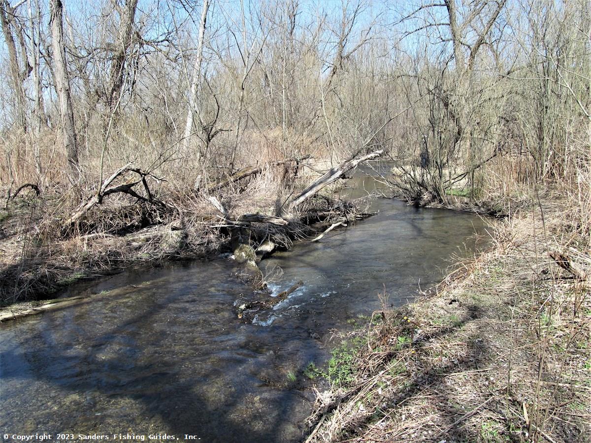
Springwater Creek is the principal tributary of Hemlock Lake, which it enters on the south end. The stream originates in a heavily wooded area known as Pokamoonshine Hollow (the uppermost section is occasionally referred to as Pokamoonshine Hollow Creek), which is about a half mile north of the Steuben County line. It flows east along Pokey Moonshine Road for about 1.5 miles and then turns north and flows for another 8.5 miles before flowing into the lake. Numerous small tributaries flow into Springwater Creek, but the only fishable tributary is Limekiln Creek, which flows into Springwater Creek about a third of a mile north of Kellogg Road. If you intend to find the junction of these streams, be sure to wear hip waders, as this is a very swampy area.
The uppermost section of Springwater Creek, from the headwaters to about half way down Lawrence Gull Road, averages no more than 5 feet in width, has a bottom of gravel and cobble, and is heavily cloaked with streamside vegetation. Springs provide the stream with a good year-round flow of cold, clean water. All of this section of the stream is on private property, but if you can get permission to fish here, you will find a healthy population of wild brook trout and a smattering of wild rainbow trout.
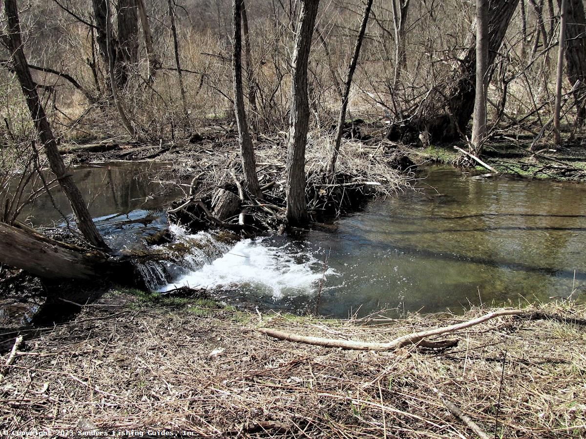
This section of Springwater Creek is somewhat distinct from the remainder of the stream due to the presence of a small waterfall/cascade where the stream flows along Lawrence Gull Road. I'm not sure exactly where this falls is located, but some conservation officers consider this to be an impassable barrier, while others do not. Pete Austerman, a fisheries biologist in DEC Region 8, thinks this falls/cascade is impassible most of the time but that occasionally a few rainbows will make it above the falls when water levels are high; this is why a few wild rainbows are found up in the Pokamoonshine area. The potential for a few fish to get above the falls makes it difficult to determine where Finger Lakes tributary regulations end and inland trout fishing regulations begin. The DEC should probably define this falls/cascade as either passible or impassible in the regulations.
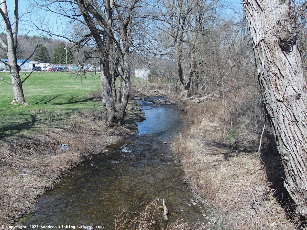
By the time the stream reaches the hamlet of Springwater, it has increased in size, but it is still rather small, ranging from about 10 to 15 feet in width, and has a gravel and cobble bottom. Surrounded primarily by woodlands, bank cover is extensive along most of the stream except for where it flows through the hamlet, where some areas are nearly devoid of streamside cover. Juvenile wild rainbow trout are fairly abundant in the section of Springwater Creek extending from the falls/cascade along Lawrence Gull Road downstream to Kellogg Road, a distance of about 3.5 miles, and their density is comparable to that in other Finger Lakes tributaries.
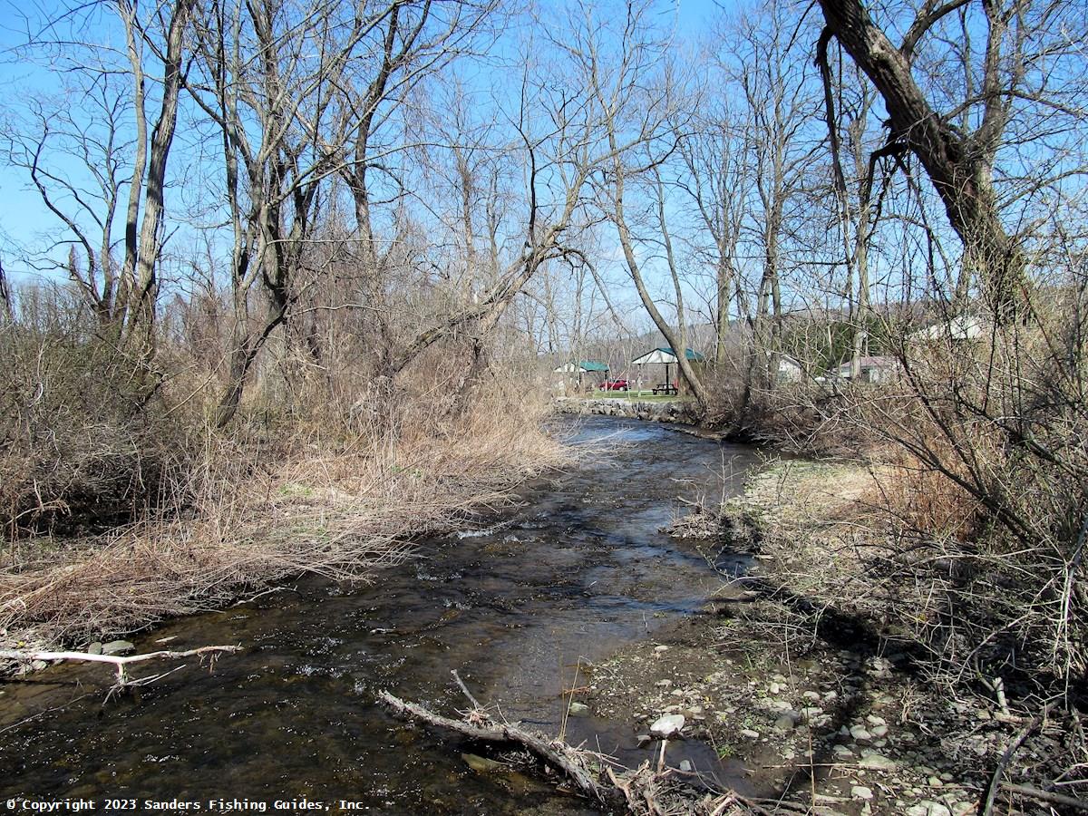
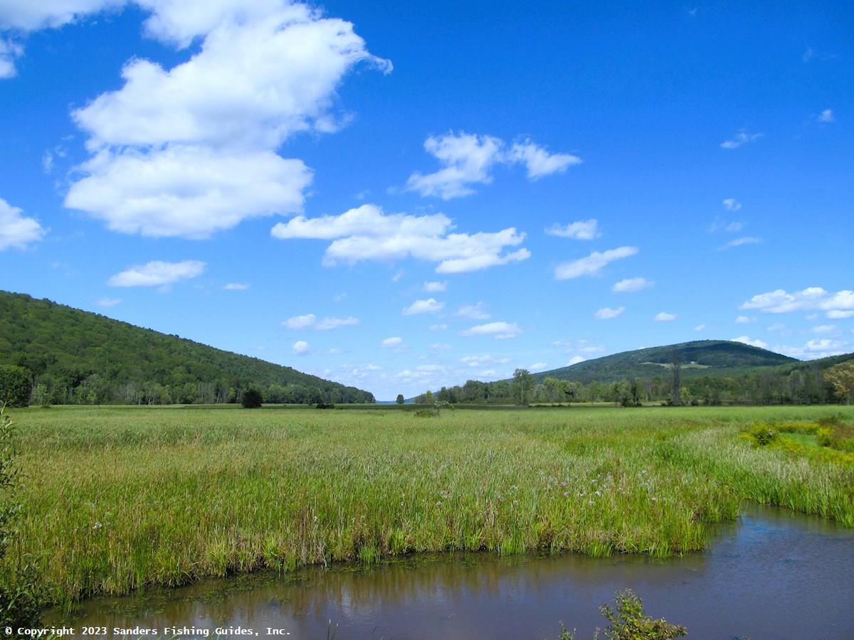
Shortly downstream of the hamlet, the land along Springwater Creek becomes increasingly swampy. By the time the stream flows under Kellogg Road and enters Hemlock-Canadice State Forest, the footing is often a quite soggy, especially in the spring, because almost all of the land between Kellogg Road and Hemlock Lake is a state-designated wetland. This can make hiking along the stream a bit difficult, but the effort can be well rewarded, as adult rainbow trout from Hemlock Lake enter the stream in large numbers to spawn. The runs begin in mid-fall and last until mid-spring. In early fall, a few brown trout from the lake also enter the stream. These trout can also be found in the previously mentioned Limekiln Creek. The small size of these streams and the amount of streamside vegetation make flyfishing here difficult, and the most common method for taking these lake-run trout is fishing with an egg sac.
In addition to fishing, Springwater Creek is a great place for spotting birds, especially where it flows through the south end of the state forest. See eBird List under Links for a list of the species that have been spotted here.
If you plan on accessing Springwater Creek anywhere within Hemlock-Canadice State Forest, be aware that this is a very swampy area and not a place you want to get lost in. Be prepared and bring along the Ten Essentials for Hiking (see Links). Especially make sure you have a compass with you.
To ensure public access, the DEC has purchased 1.8 miles of public fishing rights (PFRs) along Springwater Creek. In addition, north of Kellogg Road this stream flows through the Hemlock-Canadice State Forest, all of which is open to public fishing. (The map pin located on the crossing at Kellogg Road, immediately south of the state forest).
Note: Springwater Creek is misidentified as Limekiln Creek on some maps (e.g., Bing Maps). Limekiln Creek is the tributary that enters Springwater Creek 1,800 feet north of Kellogg Road and just west of State Route 15A.
__________________֍__________________
Links to associated resources (Hemlock Lake and Hemlock-Canadice State Forest) will be added soon.
See Location Map (above) and DEC public fishing rights map (under Links). Note that the stocking and regulations information presented with the PFR map may be out of date. See the stocking list (if stocked) and regulations guide for current information.
Road Access:
Boat Launch Site(s):
No boat launch sites are located on this stream. Also, if you look at the lower end of Hemlock Lake on Google Maps or any other aerial app, it looks like you could launch a kayak or canoe from the lake's southern launch area and paddle over to the mouth of the stream. However, every time I've tried to do this, the water in the lake and the mouth of the stream were too low, and I couldn't get into a navigable part of the stream.Management Category: Wild/Uncategorized
Fish Species:
Stocking Information: Not stocked.
Special Fishing Regulations:
From April 1 to December 31, Finger Lakes tributaries regulations apply to brown trout, rainbow trout, lake trout, and Atlantic salmon upstream to the first barrier impassible to fish (see text for additional information):
Minimum Length: 15 inches
Daily Limit: 3 in combination, and catch shall include no more than 1 rainbow trout.